


SIDELL 2 Voting District, Vermilion County, Illinois
About
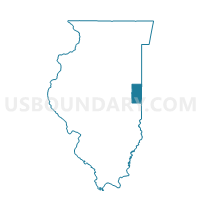
Outline

Summary
| Unique Area Identifier | 574985 |
| Name | SIDELL 2 Voting District |
| County | Vermilion County |
| State | Illinois |
| Area (square miles) | 22.60 |
| Land Area (square miles) | 22.60 |
| Water Area (square miles) | 0.00 |
| % of Land Area | 100.00 |
| % of Water Area | 0.00 |
| Latitude of the Internal Point | 39.93475850 |
| Longtitude of the Internal Point | -87.91001360 |
Maps


Graphs
Select a template below for downloading or customizing gragh for SIDELL 2 Voting District, Vermilion County, Illinois


Neighbors
Neighoring Voting District (by Name) Neighboring Voting District on the Map
- AYERS Voting District, Champaign County, IL
- JAMAICA Voting District, Vermilion County, IL
- NEWMAN Voting District, Douglas County, IL
- SIDELL 1 Voting District, Vermilion County, IL
- SOUTH HOMER Voting District, Champaign County, IL
- VANCE 1 Voting District, Vermilion County, IL
- YOUNG AMERICA 1 Voting District, Edgar County, IL
Top 10 Neighboring County Subdivision (by Population) Neighboring County Subdivision on the Map
- South Homer township, Champaign County, IL (1,601)
- Newman township, Douglas County, IL (1,080)
- Sidell township, Vermilion County, IL (1,073)
- Vance township, Vermilion County, IL (1,057)
- Young America township, Edgar County, IL (726)
- Ayers township, Champaign County, IL (453)
- Jamaica township, Vermilion County, IL (202)
Top 10 Neighboring Place (by Population) Neighboring Place on the Map
Top 10 Neighboring Unified School District (by Population) Neighboring Unified School District on the Map
- Heritage Community Unit School District 8, IL (3,107)
- Shiloh Community Unit School District 1, IL (2,803)
- Jamaica Community Unit School District 12, IL (2,409)
Top 10 Neighboring State Legislative District Lower Chamber (by Population) Neighboring State Legislative District Lower Chamber on the Map
Top 10 Neighboring State Legislative District Upper Chamber (by Population) Neighboring State Legislative District Upper Chamber on the Map
Top 10 Neighboring 111th Congressional District (by Population) Neighboring 111th Congressional District on the Map
Top 10 Neighboring Census Tract (by Population) Neighboring Census Tract on the Map
- Census Tract 108, Champaign County, IL (4,534)
- Census Tract 109, Vermilion County, IL (3,193)
- Census Tract 9520, Douglas County, IL (2,345)
- Census Tract 702, Edgar County, IL (1,991)
Top 10 Neighboring 5-Digit ZIP Code Tabulation Area (by Population) Neighboring 5-Digit ZIP Code Tabulation Area on the Map
- 61849, IL (1,842)
- 61841, IL (1,386)
- 61942, IL (1,202)
- 61876, IL (800)
- 61816, IL (509)
- 61810, IL (361)